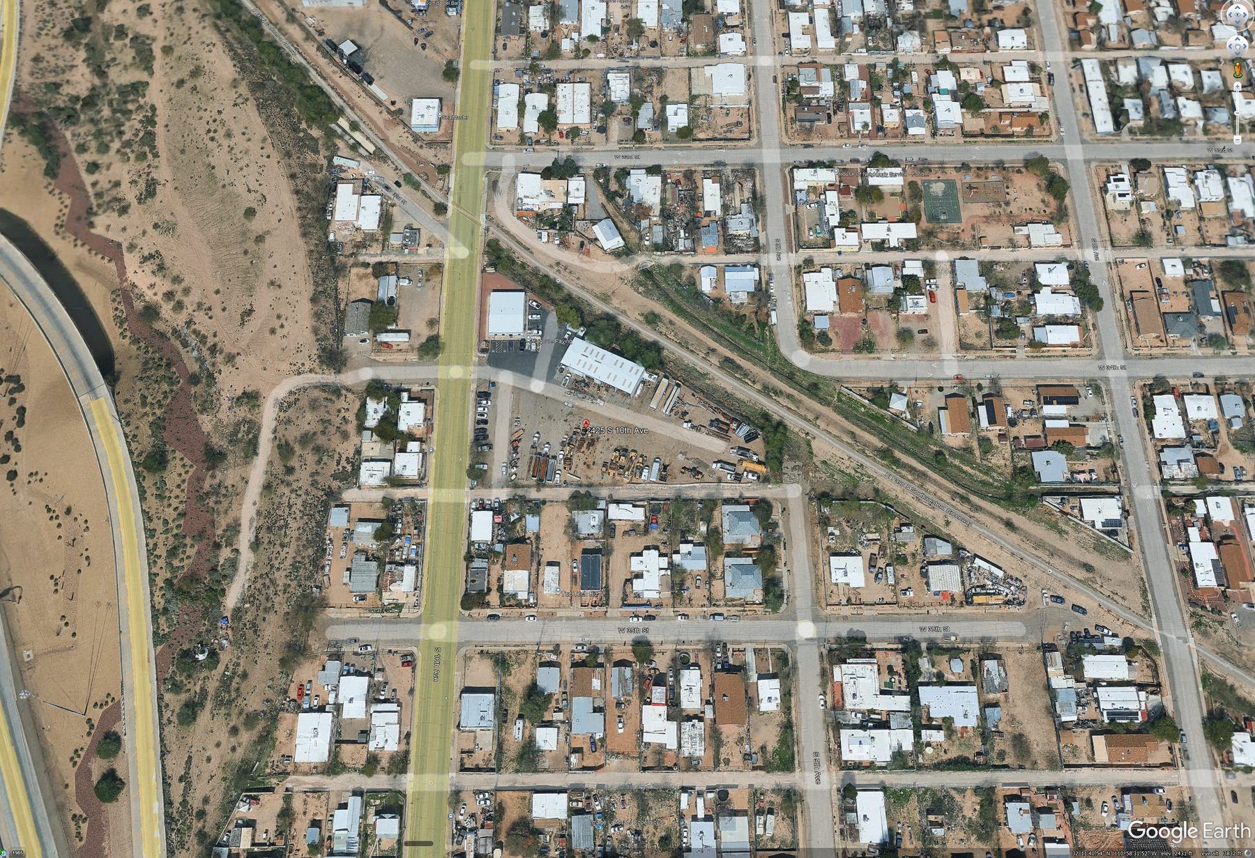
§ 04 · The host parcel
Forty-one years on this corner — and one structure that didn't stay where it was built.
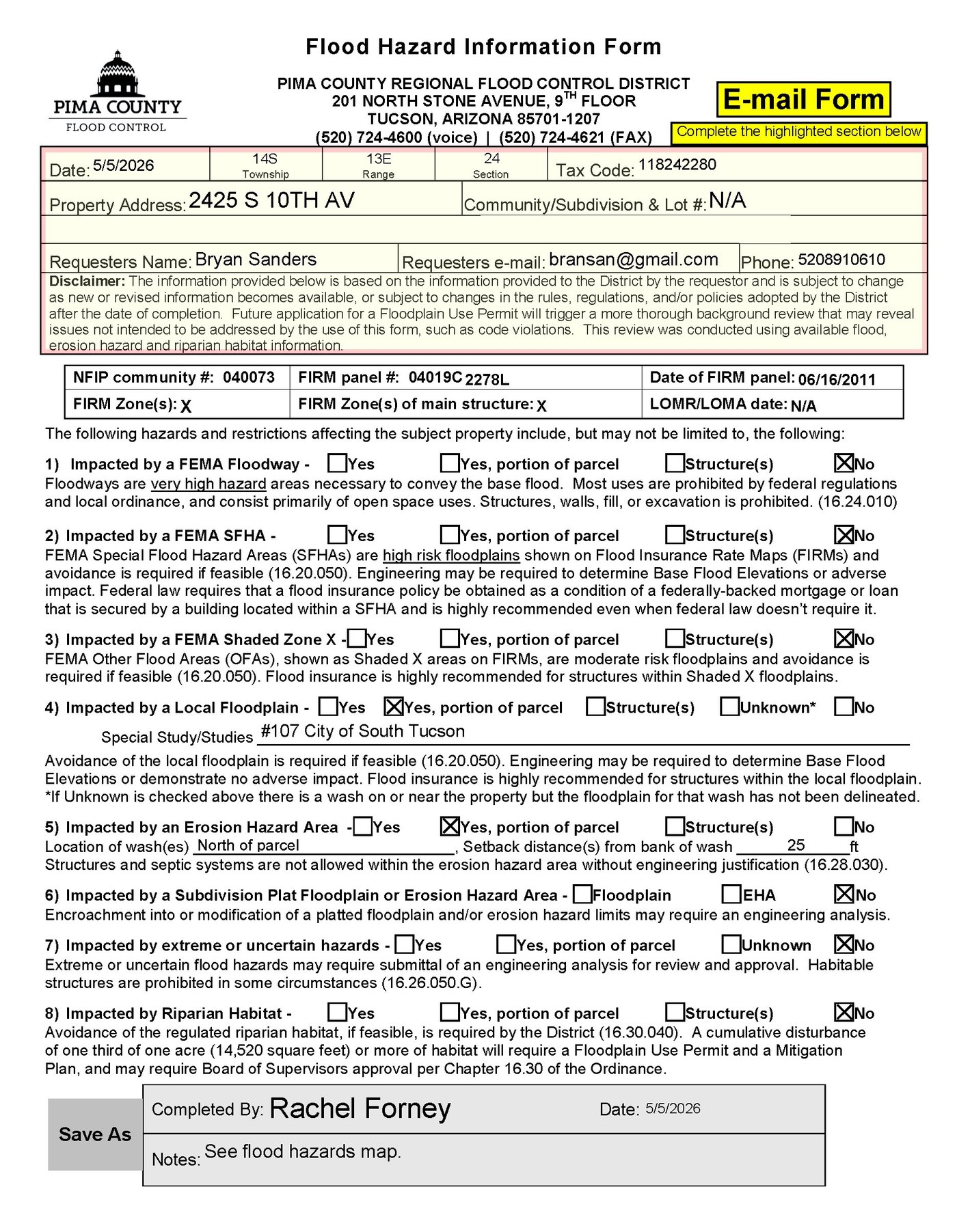
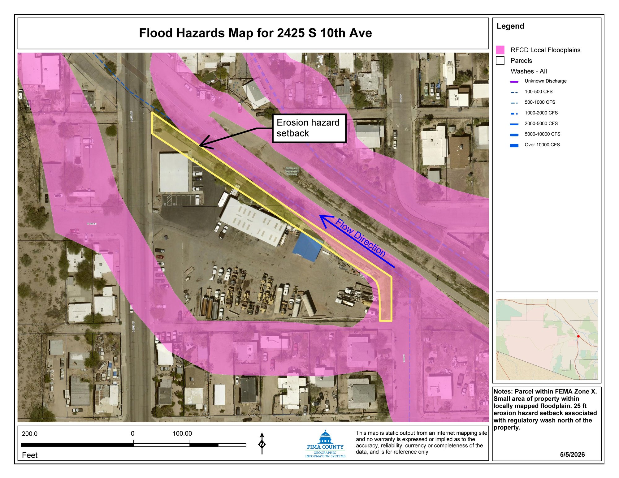
A timeline of 2425 S. 10th Avenue, the Magnum Paving lot, from the founding of the company in 1985 through the variance approved in February 2026. The August 2024 storm event is one of the things on this timeline. The seven required findings under § 24-21(c)(5) — that any variance "will not be detrimental to the public welfare nor injurious to other property or improvements in the neighborhood" — were not made on the record at the BOA 25-01 hearing.
-
March 1, 1985
Magnum Paving, Inc. is founded.
Arizona for-profit corporation, ROC general commercial license A-099088 (and subsequent specialty licenses 119328, 076062). The company sets up paving operations at 2425 S. 10th Avenue, where it has remained for forty-one years.
-
1985 – 2024
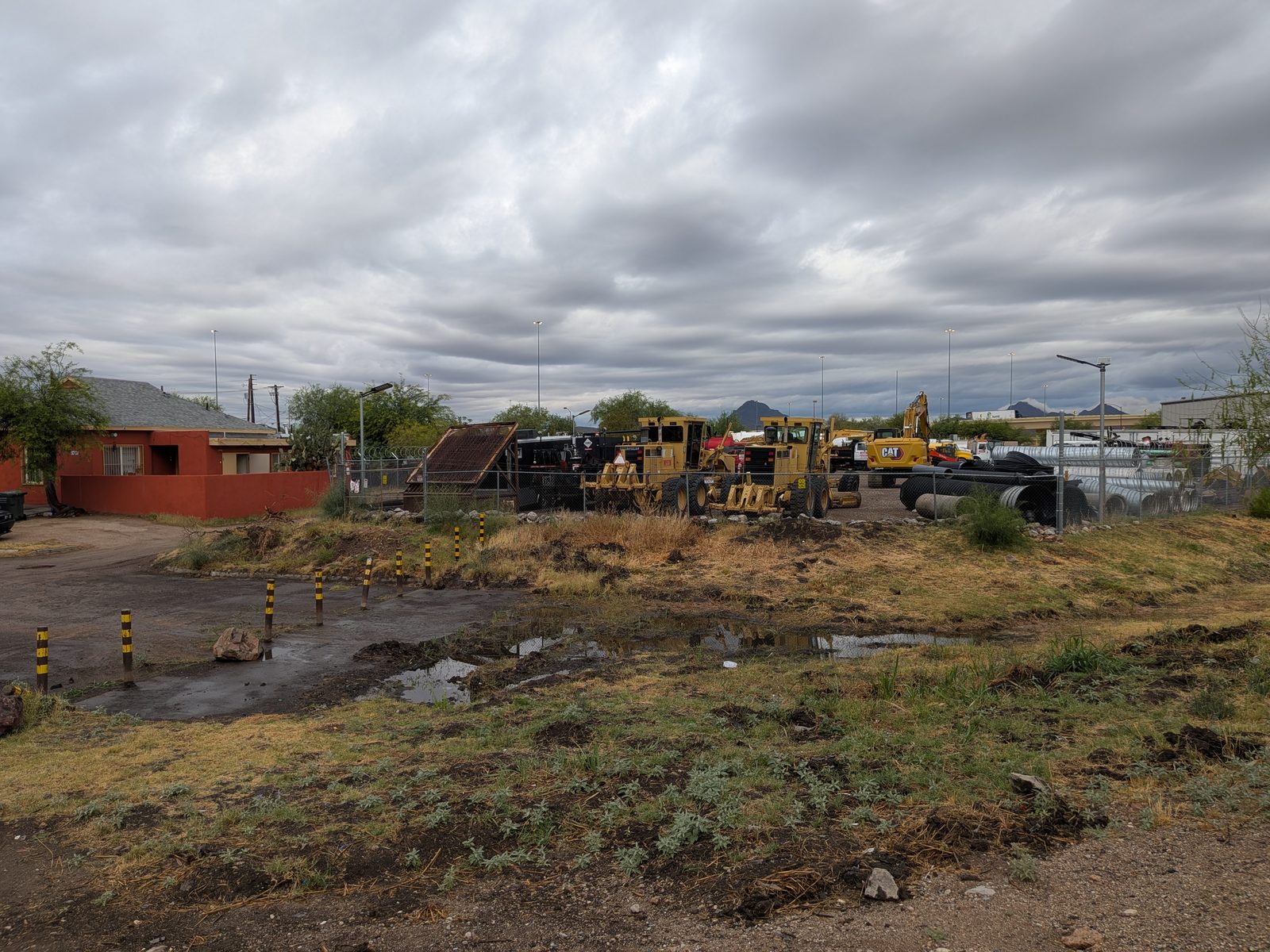
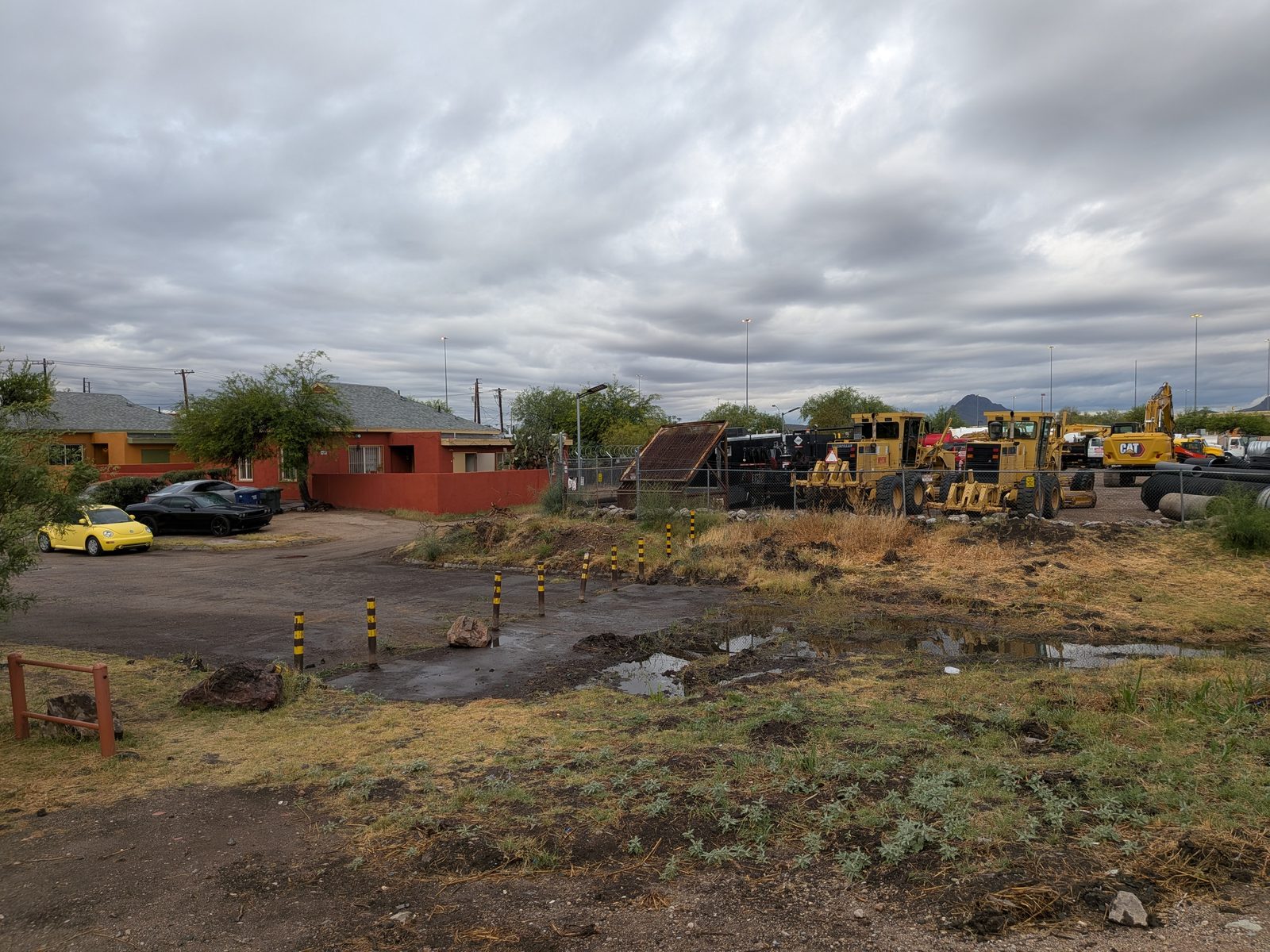
Four decades of paving operations on a residential block.
The 1.7-acre rectangular parcel runs heavy equipment, asphalt operations, drainage culverts. The block to the south is residential — single-family homes, mostly Hispanic-occupied, separated from the lot by a single alley. None of the surrounding homeowners bought their property expecting a 70-foot wireless tower in their viewshed; they bought next to a paving contractor.
At some point during this period a 20-foot by 60-foot A-frame metal roof structure is built on the parcel.
-
August 20, 2024
The 20×60 metal roof structure leaves the parcel during a regional storm event.
During a documented storm passing over Pima County, the entire 20-foot by 60-foot A-frame metal roof — including its supporting framing — is displaced from the Magnum Paving parcel. It comes to rest on the property at 2320 S. 9th Avenue, destroying fencing, a shed, trees, and a 1,000-gallon water tank. The homeowner's written statement, now part of the South Tucson Council public record, describes the event as one that "almost killed someone."
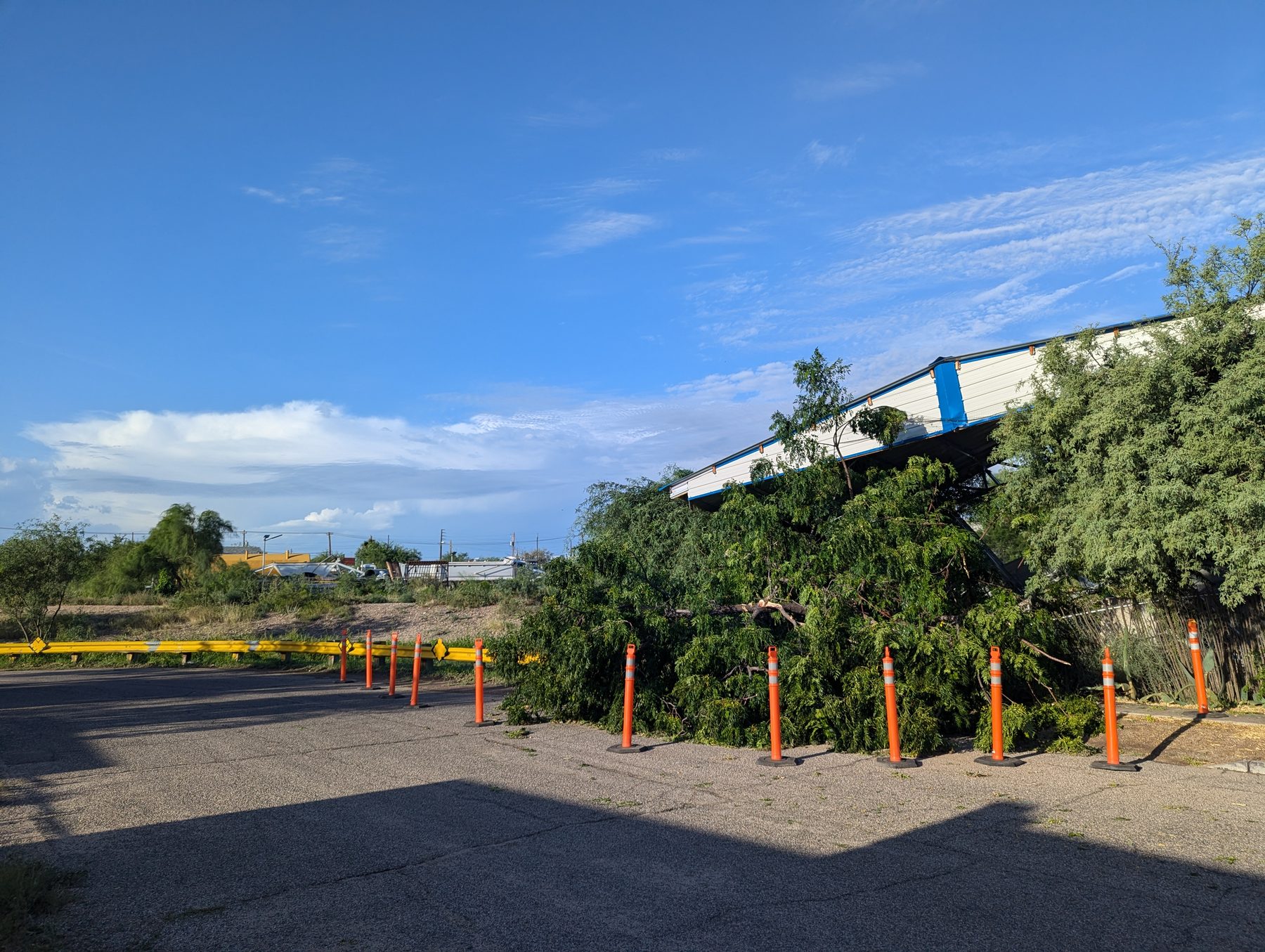
August 21, 2024 · 7:13 AM. The displaced metal roof structure suspended in the tree canopy at the 2320 S. 9th Avenue property. Orange traffic cones mark the affected area. Photographed by Bryan Sanders the morning after the storm; EXIF and GPS metadata preserved. -
August 21, 2024 · 7:13–7:24 AM
The aftermath is photographed.
Twelve photographs with EXIF and GPS metadata intact preserve the displacement trajectory. One image shows both the structure's original anchor location on the Magnum Paving parcel and its final resting position on the affected property — fixing the trajectory on the record.
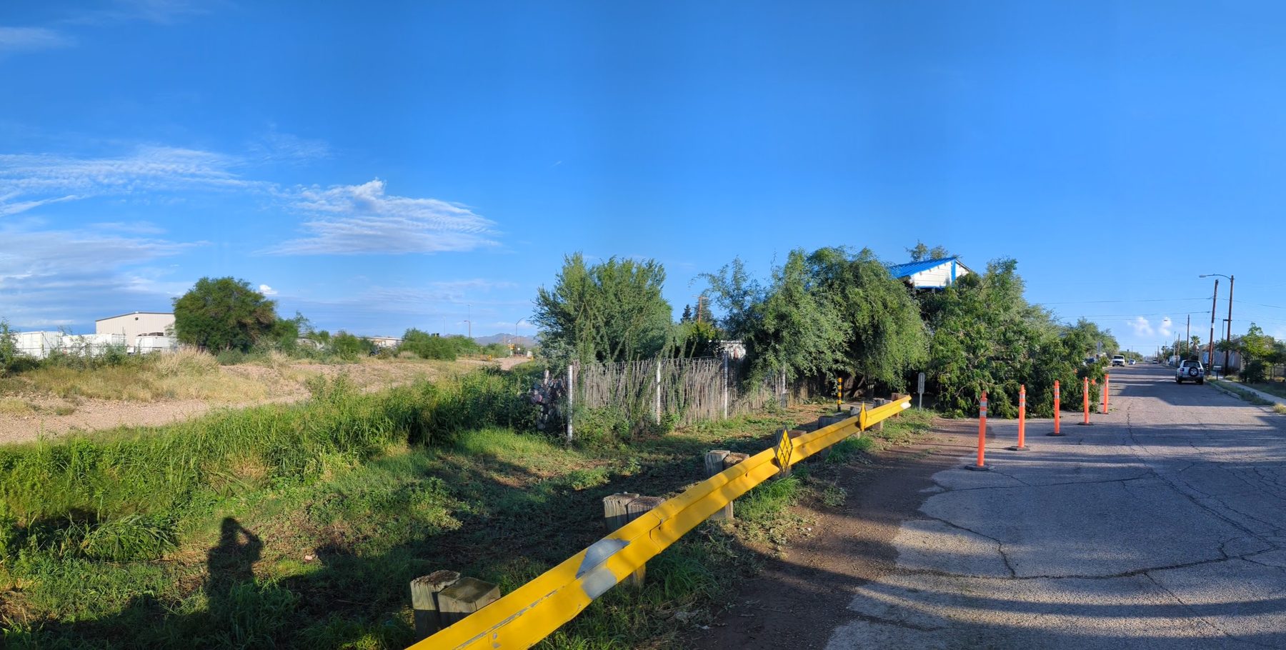
7:15 AM · Wide view from the affected property side 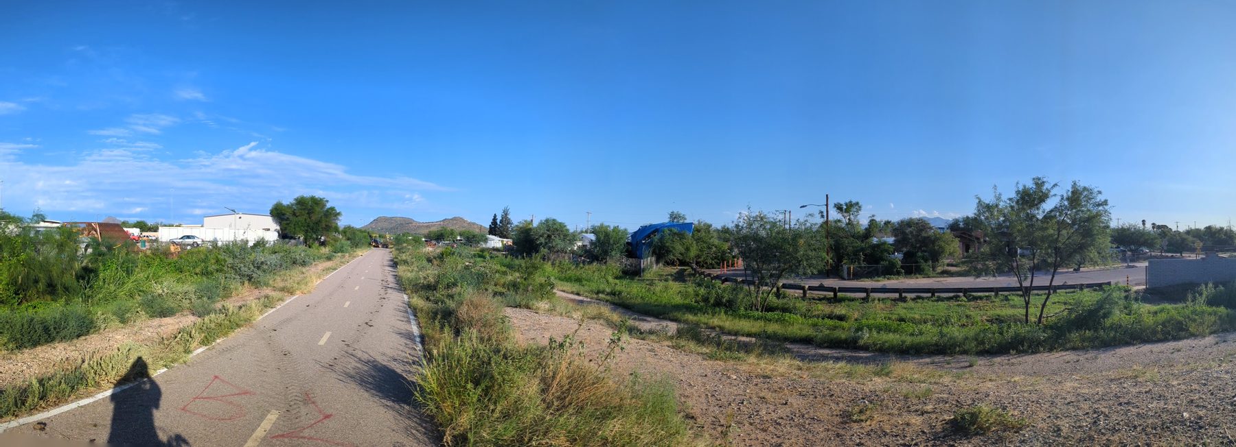
7:24 AM · Magnum lot at left, displaced structure at right — one frame 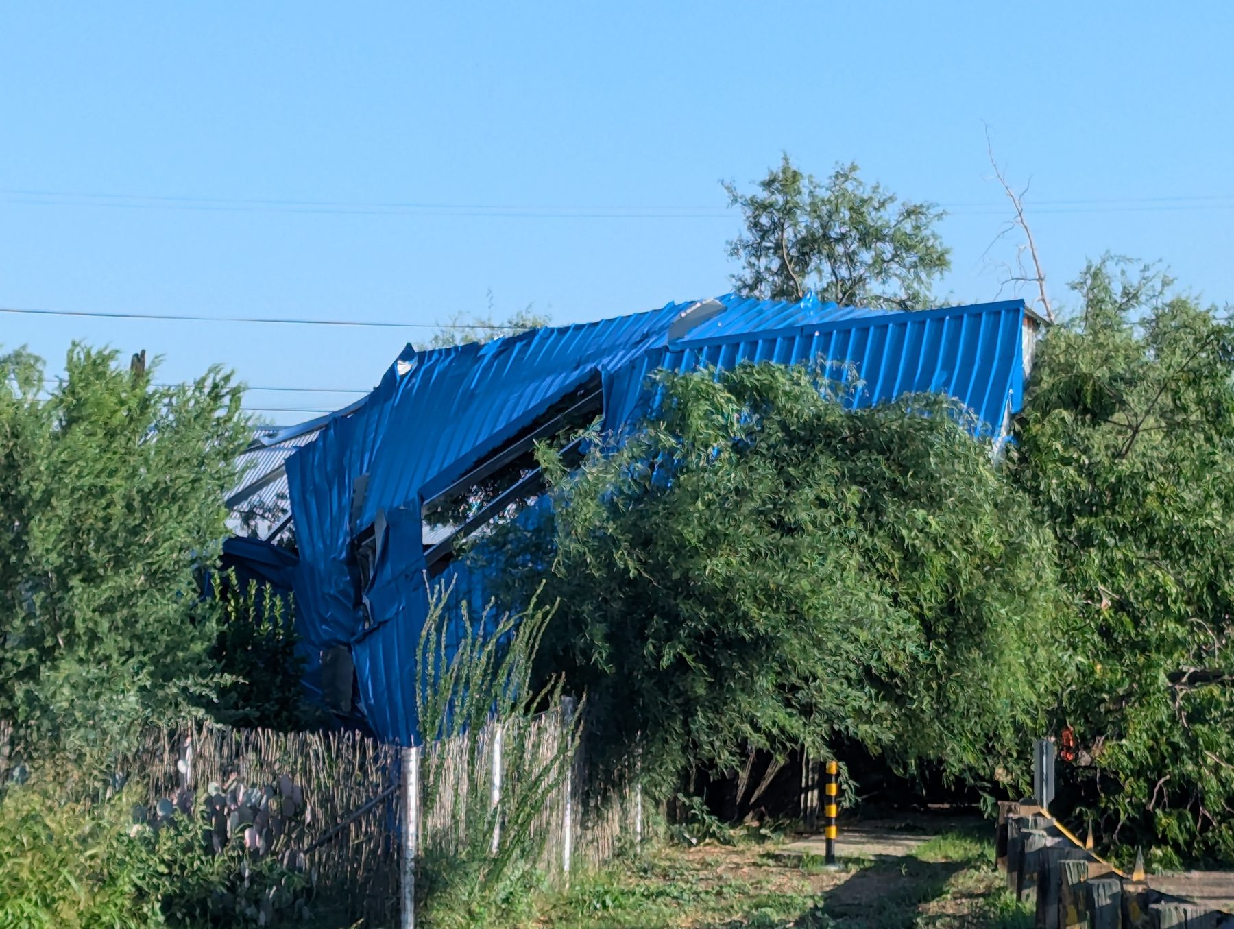
7:24 AM · Close-up of the corrugated panels in the canopy 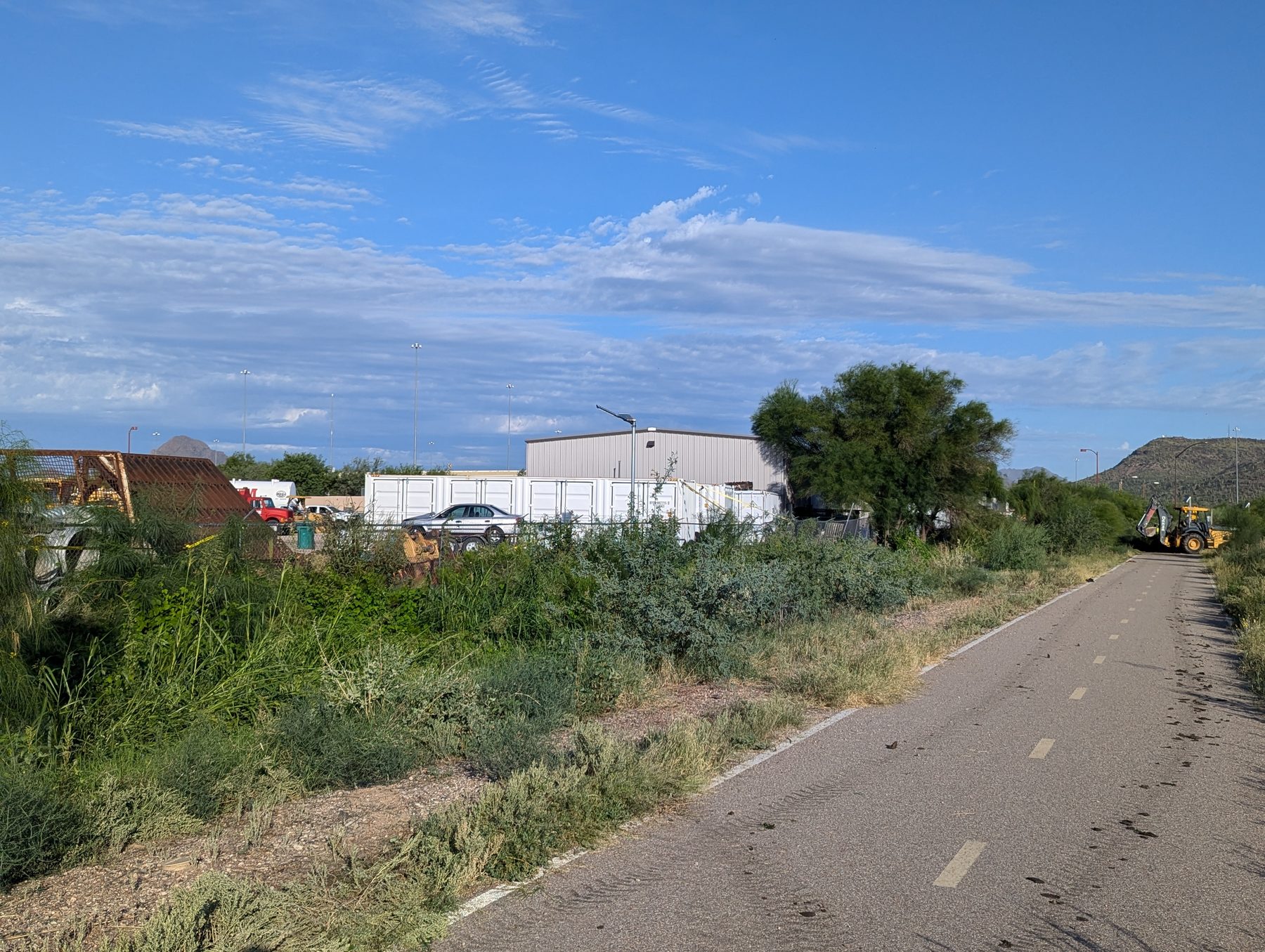
7:24 AM · The Magnum Paving lot from the greenway side -
September 27, 2024
Title to the parcel transfers to a newly named LLC.
Six weeks after the storm event, title to 2425 S. 10th Avenue transfers from prior ownership to Hawesome Properties LLC. Pima County Recorder Sequence 20242710479. The LLC's mailing address is the same PO Box as Magnum Paving (PO Box 50562, Tucson AZ 85703-0562). The name combines "Haws" — Magnum's president — with "awesome."
-
October 12, 2025
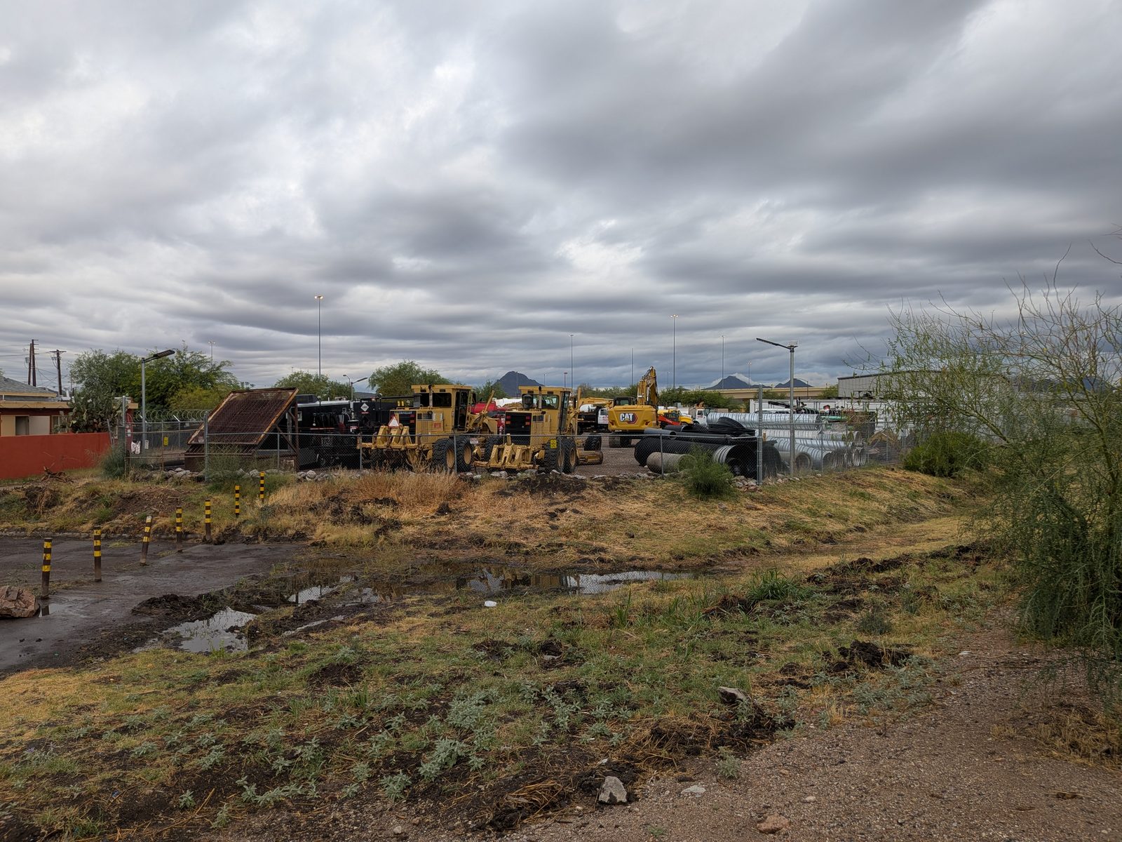
Recurrent flooding north of the parcel is photographed.
Photographic and video evidence documents standing water in the regulatory wash directly north of the parcel — the corridor that an applicant's representative would later characterize, in a different forum, as "open space greenbelt parcel."
-
Date pending — Public Records Request
Site selection, application planning, and filing.
When Verizon began identifying potential tower sites in South Tucson, when the property owner and the wireless siting representative first engaged on this parcel, when site survey and engineering work was performed, when application materials were prepared, and when the variance application was finally filed with the City — none of this is yet on the public record. The May 1, 2026 Public Records Request asks for the complete application file, all supporting materials, and the date-stamped intake. Until those records are produced, this part of the timeline remains a question.
-
February 25, 2026 · 3:04–3:39 PM
BOA 25-01: setback variance for a 70-foot Verizon cell tower approved 4–0.
The South Tucson Board of Adjustment approves the variance in a 33-minute hearing. The 33:46 audio contains no mention of the August 2024 structure failure on the same parcel. The seven required findings under § 24-21(c) — including (5), the affirmative finding that the variance "will not be detrimental to the public welfare nor injurious to other property or improvements in the neighborhood" — are not made on the record.